PhotoPills
- 4.8
- Rating
- 100.00K
- Installs
- $10.99
- Price

 Analysis by App-foxy
Planning a landscape, night-sky, or moon photograph often fails before the camera is even unpacked. The light may arrive from the wrong direction, the Moon may be hidden behind a ridge, or the Milky Way may sit just outside the composition you imagined. PhotoPills is a photography app built to reduce that guesswork by turning a location and a time into a practical shooting plan. I found it most useful when I treated it as a preparation tool rather than a camera replacement.
Developed by PhotoPills, SL, this paid photography app costs $10.99 and is aimed at photographers who care about the position of the Sun, Moon, and Milky Way. Its store summary promises a way to plan those scenes quickly, but the real value is less about pressing one magic button and more about checking several details before a trip. The app has an Everyone age rating, works from Android 5.0 onward, and its current version is 1.8.23.
Its reputation is strong: the app holds a 4.8 average from around 8,200 ratings, with more than 500 written reviews and over 100,000 installs. Those figures suggest a dedicated audience rather than a casual crowd. That distinction matters. If you only take spontaneous phone photos, the app may feel excessive. If you have ever driven somewhere before sunrise and discovered that the scene was facing the wrong way, it becomes much easier to justify.
You May Also Like

 AccuWeather: Weather Radar
AccuWeather Review: A Quick, Clear Forecast for Everyday Decisions
For everyday plans, the best forecast is the one you can understand quickly. AccuWeather makes rain timing, radar, and local conditions easy to act on, with a few trade-offs.

 Hill Climb Racing
Why Hill Climb Racing Still Turns Crashes Into One More Run
A tiny car, a bumpy hill and one more upgrade: Hill Climb Racing keeps resurfacing because its simple chaos makes every near-miss feel personal.

 AliExpress - Shopping App
AliExpress Makes Global Shopping Feel Personal, but Shoppers Bear the Risk
AliExpress turns a global marketplace into a pocket-sized discovery engine. Its reach is useful, its shopping loop compelling, and its trade-offs easy to miss.

 Lords Mobile: Kingdom Wars
Lords Mobile Is a Kingdom-Building Routine, Not a Quick Match
A case-by-case verdict on the building, battles, device demands, and social commitments that make Lords Mobile rewarding for some players and exhausting for others.

 PDF Scanner app - TapScanner
TapScanner Makes Paperwork Easier to Capture, Check, and Share
TapScanner makes scanning with a phone feel less like a rescue operation and more like a dependable step in getting work done. Its capture tools are useful, though not flawless.

 Block Blast!
 Shows How Much a Puzzle Game Can Leave Out
A quiet grid game shows why puzzle players increasingly value instant clarity, repeatable skill and low-pressure play—and where the genre still needs to catch up.
More From Our News Desk
View All News


Where planning usually gets stuck
The first difficulty is understanding what the app is trying to solve. PhotoPills does not simply tell you that sunrise happens in the morning or that the Moon will be visible at night. Its usefulness comes from connecting astronomical timing with a real viewpoint. You still need to decide where you want to stand, what you want in the foreground, and how wide or tight your composition should be.
That means the most common mistake is opening the app without a clear location. A broad city search can be a starting point, but it is not the same as choosing the actual overlook, beach, road, or field where the photograph will be made. A small change in position can alter the horizon, the available foreground, and the apparent relationship between the subject and the sky. I get better results when I begin with a recognizable shooting spot instead of trying to solve the entire composition inside the app.
Another point of friction is the difference between a map prediction and what the camera will really see. A line showing where the Sun or Moon travels is useful, but hills, buildings, trees, haze, and restricted access can make the theoretical alignment unusable. The app helps answer “where and when,” while the photographer still has to inspect the physical scene.
This is especially important for large subjects such as a rising Moon behind a landmark. The alignment may look perfect on a map, yet the landmark could be much farther away than expected, making the Moon appear smaller in the final frame. Conversely, a nearby subject can fill the composition sooner than planned. I would not rely on a single map check for a demanding shot; I would use it to narrow the options, then verify the viewpoint with ordinary map imagery or a daytime visit.
Why first-time users can feel lost
PhotoPills is dense because it tries to serve several kinds of photographers at once. A beginner may open it expecting one simple “best time” answer and instead encounter planning choices, map information, and photographic calculations. That depth is valuable, but it creates a learning curve. I recommend starting with one goal, such as finding the direction of a sunset at a familiar location, before attempting a complicated Milky Way composition.
The app also rewards photographers who understand the difference between an event time and a useful shooting window. Sunrise is a defined event, but the attractive light may begin earlier. A Moonrise time does not guarantee that the Moon will be visible from your exact position, and a dark-sky opportunity still depends on the direction of your composition. The practical lesson is to leave room around the headline time rather than arriving at the exact minute.
A useful habit is to write down three things after making a plan: the place to stand, the direction to face, and the time range that matters. This simple note prevents a common failure in the field, where the photographer remembers the date but forgets whether the subject was supposed to appear to the left or right of the frame.
Setup checks that prevent avoidable problems
Before trusting a plan, I would check the selected location carefully. Search results can place you near a destination without placing you at the precise viewpoint you had in mind. Move the map marker to the actual shooting position, especially if the scene involves a ridge, a bridge, or a narrow coastal path. The farther the subject is from you, the more important this precision becomes.
Location access is another practical check. A perfect alignment is not helpful if the trail is closed, the gate is locked, or the viewpoint cannot be reached safely in darkness. PhotoPills can support the planning decision, but it does not replace checking opening hours, local restrictions, weather, or the condition of the route. I treat those as separate steps in the same preparation routine.
Device setup can also affect the experience. Make sure the phone has enough battery for map use in the field, and download or prepare anything you need before leaving an area with weak reception. I would not wait until standing on a dark hillside to discover that the map view is difficult to load or that the screen brightness is too low to read comfortably.
Compass-based direction deserves special care. Phones can show a heading that is temporarily inaccurate because of nearby metal, vehicles, magnetic accessories, or simple sensor drift. If an on-screen direction seems inconsistent with the landscape, move away from the interference and recalibrate the phone according to its normal system instructions. Then compare the result with a visible landmark rather than accepting the first reading automatically.
This is one of the most important setup checks because a small directional error can become a large compositional error at a distant horizon. I use the compass as a guide, not as an unquestionable measurement. The map, the physical terrain, and the phone should broadly agree before I commit to a long drive.
A reliable preparation routine
For a sunrise landscape, I begin by selecting the viewpoint and checking the direction of the Sun. Then I inspect the surrounding terrain and decide where the foreground should sit. I save the essential details in a note or screenshot, including the planned position and the approximate arrival time. Finally, I check the weather through a separate source because astronomical accuracy cannot overcome cloud, fog, or heavy haze.
For a Milky Way plan, I reverse the emphasis. I first decide which foreground subject deserves the frame, then check whether the sky position supports that orientation. I also consider whether artificial light, nearby buildings, or a bright Moon will weaken the result. The app can help me understand the celestial arrangement, but the final image still depends on darkness, visibility, lens choice, focus, and exposure technique.
That division of labor makes the app easier to use. PhotoPills handles the planning logic; other tools and ordinary observation handle practical conditions. Expecting one application to answer every question is what creates much of the frustration.
Recovering when a plan does not work
When a planned alignment looks wrong, I do not immediately assume the app has failed. I first check whether the map marker moved, whether the date or time zone is correct, and whether the selected location is the actual place where I intend to stand. These are simple checks, but they account for many apparent errors in planning applications.
Next, I compare the predicted direction with a real landmark. If the app indicates that the Sun should appear behind a hill but the horizon is blocked by trees from my position, the issue may be the viewpoint rather than the calculation. Moving a short distance can sometimes solve the problem, although it may also change the foreground and the apparent scale of the subject.
For a Moon or Sun composition, scale is a frequent source of disappointment. The application may correctly predict the alignment while the final photograph still looks different from the mental image because the camera position, focal length, and distance to the subject were not considered together. A distant landmark generally requires a different approach from a nearby object. I use the plan to determine timing and direction, then think separately about how much of the frame the subject can occupy.
It is also wise to build a recovery plan. If clouds cover the main horizon, can you photograph the changing light from a secondary viewpoint? If the exact alignment is missed, is there a wider composition that still works? The best use of PhotoPills is not always a single rigid target. It can help create alternatives, so the entire outing does not depend on one perfect minute.
One non-obvious advantage is that planning can improve scouting even when the original image is abandoned. A failed alignment may reveal a better foreground, a safer place to stand, or a more interesting direction for a later visit. I often regard the first trip as information gathering rather than wasted effort, particularly when the location is unfamiliar.
What to do when the screen and the scene disagree
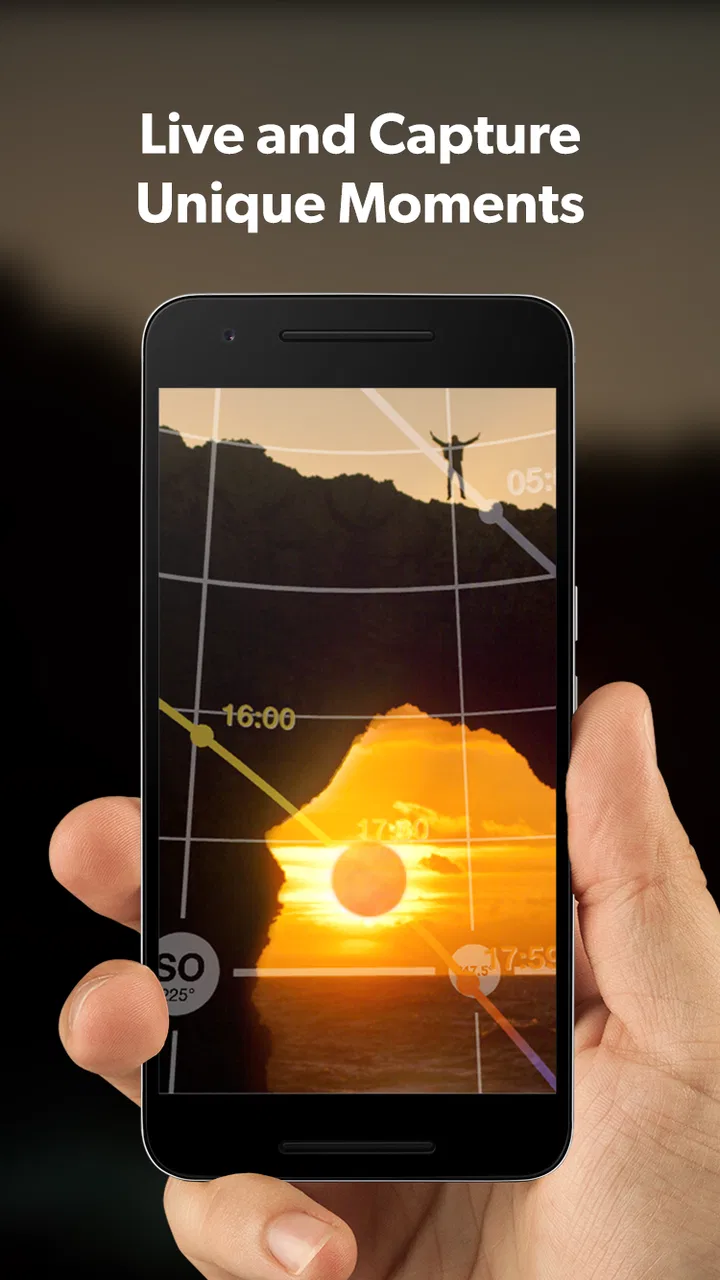
If the augmented or directional view appears offset, step through the basic causes in order. Confirm the map position, check the phone’s compass against a known direction, and look for nearby magnetic interference. Hold the device steadily and compare the predicted path with a distant, identifiable feature. If the discrepancy remains, use the map and the landscape as the primary references rather than forcing the live view to match your expectation.
Do not make a risky move merely to satisfy the screen. A road edge, cliff, shoreline, or dark trail is not made safe by a promising alignment. I would rather accept a less dramatic composition than stand somewhere unstable or trespass for a theoretical shot. Planning is supposed to reduce uncertainty, not encourage unsafe shortcuts.
When the app is not the cause
Photography planning has several variables that can look like software problems. Weather is the obvious one, but atmospheric haze can be just as disruptive. A Moon that is technically above the horizon may be difficult to see through low cloud or pollution. The Sun can be in the predicted position while the light is softened by mist. A Milky Way plan can be geometrically sound and still produce a weak result if the sky is not transparent.
Camera technique creates another layer. If the photograph looks too dark, too bright, or blurred, that is not evidence that the planning was incorrect. Focus, shutter speed, aperture, stabilization, and exposure decisions remain the photographer’s responsibility. I use the app to decide when and where to work, then I make a separate camera plan suited to the scene.
Time settings deserve particular attention. A phone can display a different time zone from the one assumed during planning, especially when traveling. Before leaving, I check the local time and confirm that the date is correct. Around midnight, a small date mistake can move the entire plan to the wrong night. This is a general setup issue, not a special defect of the application, but it is easy to overlook when the target is an astronomical event.
There is also a difference between precision and certainty. A detailed prediction can give the impression that the final image is guaranteed. It is not. Terrain data, visibility, access, weather, and human timing all matter. I appreciate the app most when I use its precision to make better decisions while keeping the creative plan flexible.
Compared with a basic weather app, a normal map, or a simple compass, PhotoPills brings the photographic question into one planning environment. Those alternatives are still useful: a weather service is better for cloud and wind, a map may be better for route research, and the phone’s compass can provide a quick orientation check. The advantage here is the connection between astronomical movement, a chosen location, and a camera-minded composition. The trade-off is that the app takes more time to learn than those simpler tools.
Compared with relying on intuition, it is particularly helpful for scenes that depend on alignment. I would not necessarily open it for a casual sunset from a familiar balcony. I would open it before traveling to a remote viewpoint, planning a landmark Moon shot, or trying to place the Milky Way behind a specific foreground. In those cases, a little preparation can prevent an expensive and tiring mistake.
Who will benefit and who should skip it
I think the app is a strong fit for landscape photographers, night photographers, travel shooters, and anyone who plans around a specific celestial position. It is also useful for photographers who prefer scouting before a trip instead of improvising after arrival. The paid price makes more sense when a single successful outing can save fuel, time, or a return journey.
It is less suitable for someone who wants an uncomplicated camera app with filters, automatic enhancement, or instant sharing. PhotoPills is not where I would send a friend who simply wants to take better everyday snapshots. It is a planning instrument, and its value increases with the complexity of the intended photograph.
Beginners should not be discouraged by the depth, but they should expect to learn gradually. Start with one location and one subject. Make a simple sunlight plan, visit the place in daylight, and compare the prediction with the real horizon. Once that feels comfortable, move to Moon and Milky Way planning. This approach is much less frustrating than trying to understand every planning option at once.
Experienced photographers may appreciate the control but should still avoid treating the app as an authority over the physical world. The strongest workflow combines its astronomical planning with route checks, weather information, daytime scouting, and a backup composition. That combination is more dependable than any single screen.
My practical verdict after using it
PhotoPills earns its place as a serious photography tool because it addresses a real problem: being in the right place is not enough when the light or celestial subject must appear in a particular part of the frame. Its detailed planning approach can turn a vague idea into a workable outing, especially for sunrise, sunset, Moon, and Milky Way photography.
The main cost is not only the $10.99 purchase. It is also the attention required to set the location, understand the direction, check the time, and interpret the result realistically. That friction is worthwhile for deliberate landscape work, but unnecessary for casual photography. I would rather see a new user spend a few short sessions learning the workflow than judge the app after one confusing attempt.
My recommendation is straightforward: buy it if you regularly plan photographs around the sky, a distant landmark, or a precise viewpoint. Skip it if you only need quick snapshots or a simple weather forecast. For the right photographer, the app’s real strength is reducing wasted journeys without pretending to remove every uncertainty. Once I combine its plan with sensible scouting and a backup idea, I feel more prepared—and still leave enough room for the scene to surprise me.
FAQs for PhotoPills
01What is PhotoPills used for?
PhotoPills is a planning app for photographers who want to predict and organize outdoor shots. It helps you check the position of the Sun, Moon, and Milky Way, calculate depth of field and exposure settings, plan time-lapse sequences, and identify useful shooting dates and locations. It is particularly valuable for landscape, night, travel, architectural, and astrophotography projects.
02Does PhotoPills work without an internet connection?
Many of PhotoPills’ core planning tools can be used offline after the necessary maps and data have been loaded, which is useful when photographing in remote areas. However, some features may depend on current location services, downloaded map content, or updated astronomical information. It is best to open the app and prepare your plans before leaving reliable Wi-Fi or mobile coverage.
03Is PhotoPills suitable for beginners, or is it only for professional photographers?
PhotoPills can be used by beginners, but its large number of calculators, maps, and technical controls may feel overwhelming at first. New photographers can start with the Planner and basic Sun or Moon tools, then gradually explore exposure, depth-of-field, and star-trail features. Experienced users will appreciate the precision, while beginners should expect a short learning period.
04What devices and permissions does PhotoPills require?
PhotoPills is available for Android and iOS devices, although exact compatibility can vary according to the operating system and device model. The app may request access to location services so it can calculate local Sun, Moon, and Milky Way positions accurately. Camera-related planning does not mean the app replaces your camera, and it cannot guarantee results when conditions change.
05Does PhotoPills guarantee that a planned photo will look exactly as expected?
No planning app can guarantee a perfect photograph, and PhotoPills is no exception. Its predictions are based on astronomical calculations, maps, time, and the information entered by the user. Weather, haze, terrain, buildings, light pollution, camera limitations, and unexpected obstructions can still affect the result. Treat its plans as highly useful guidance, then verify conditions on location.
Pros
- Powerful planning tools for sun
- moon
- and Milky Way photography.
- Augmented reality helps visualize celestial positions in real locations.
- Includes detailed depth-of-field and exposure calculators.
- Works offline for many core planning features.
- Useful sunrise
- sunset
- and golden-hour information for trips.
Cons
- The interface can feel overwhelming for beginners.
- Some advanced tools require time to learn properly.
- Accurate results depend on correct location and device settings.
- Map and augmented-reality features may drain battery quickly.
- The app is paid
- which may deter casual photography users.

PhotoPills
Gallery